
Maps of the World
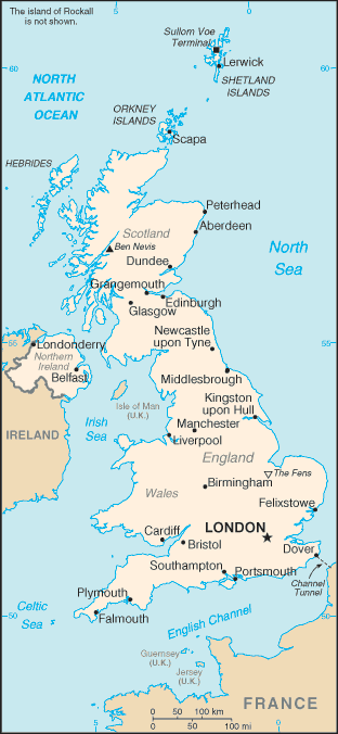
Map of United Kingdom
 for more information, see the UK Guide
capital: London
Shown on the map: Sullom Voe Terminal, Lerwick, Shetland Islands, Orkney Islands, Scapa, Hebrides, Peterhead, Aderdeen, Ben Nevis, Dundee, Grangemouth, Edinburg, Glascow, Newcastle upon Tyne, Middlesbrough, Kingston upon Hull, Manchester, Liverpool, Birmingham, The Fens, Flexixstowe, London, Cardiff, Bristol, Dover, Southhampton, Portsmouth, Plymouth, Falmouth, Londondery, Belfast, Guernsey, Jersey, Isle of Man
Not shown: Island of Rockall
More Information
The United Kingdom is made up England, Wales, Scotland and Northern Ireland.
Photos from the UK
Read the English and Scottish food diary
See the List of All Country Maps
Do you have feedback, a comment or correction? Let us know